

 DirectStay
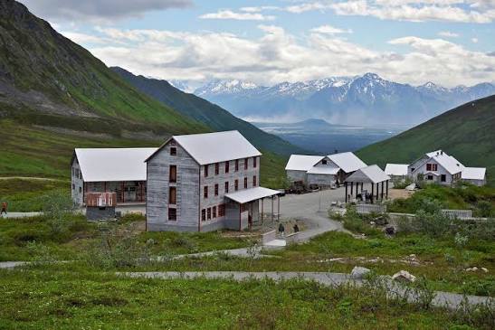
Nine hundred feet shouldn't change much. A hill in most valleys barely earns a name, let alone a trailhead. But Bodenburg Butte sits in the center of the Mat-Su Valley's alluvial plain like a glacial afterthought — a rock knob the ice carved and abandoned — and when you climb its stairs and step onto the summit, the valley stops being a place you're driving through and becomes a place you can hold in your eyes all at once. Pioneer Peak rises behind it. Knik Glacier stretches to the east. Farmland flattens below in every direction. Then there's the mountain that looms over Palmer itself — 6,398 feet of Chugach rock named in 1939 for the colony pioneers who arrived four years earlier and never quite believed what they were looking at. Most visitors see Pioneer Peak from their windshield. A few see it from the top. The question isn't which one to climb. It's how much elevation your body, your schedule, and your definition of "hike" can absorb.
Locals call it "the Butte" and leave it at that. Bodenburg Butte is a roche moutonnée — a bedrock formation shaped by glacial ice that once covered this valley thousands of feet deep. The glaciers carved it smooth on one side and rough on the other, then retreated and left it standing alone in the middle of the flattest land in the region. Trail signage at the halfway mark explains the geology. The summit explains why you bothered.
Two trails reach the top. The West Butte Trail starts from a Mat-Su Borough parking lot off Mothershead Lane and climbs roughly 750 feet over switchbacks and wooden staircases — more than five hundred steps built into the steep north face. It takes most hikers an hour to an hour and a half up. The Sandvik Family Trail starts near the Reindeer Farm and covers less distance but gains elevation faster — steeper, more scrambling, fewer stairs. Both converge on the same open summit.
What you find at the top is disproportionate to the effort. A 360-degree panorama opens across the entire valley floor: the Matanuska River curving below, the Chugach Range to the south, the Talkeetna Mountains to the north, Knik Glacier visible to the east, and Pioneer Peak filling the sky directly behind you. Families carry picnic lunches to the summit. The Butte is one of the first trails in the valley to shed its snow each spring, which means it draws hikers from Anchorage — forty-five minutes south — before most other trails are even passable.
The land surrounding the Butte is private. Respect the property owners on your way in and out. Dogs are welcome but must stay leashed — a borough ordinance enforced with citations.
Pioneer Peak's Dena'ina name is Dnal'iy — "the one that watches us." It earned the English name in 1939, honoring the Matanuska Colony families the federal government resettled here during the New Deal. The mountain is the first thing Palmer residents look at in the morning and the backdrop they measure every evening against. In winter, its mass blocks sunlight from entire Palmer neighborhoods for months — locals call that zone "the shadow."
At 6,398 feet, Pioneer Peak rises from near sea level with the kind of abruptness that makes it look closer than it is. The Pioneer Ridge Trail covers roughly thirteen miles round trip and gains more than 6,500 feet — a thousand feet per mile in the upper sections. The lower miles wind through alder and spruce. Above five thousand feet, the trail gives way to scree, loose rock, and ridge scrambling. The south summit is accessible to experienced, fit hikers. The north summit — the true summit — demands technical mountaineering skills.
This is not a family hike. It is not a morning add-on. Strong hikers who summit typically spend eight to twelve hours on the trail, and most turn around well before the top. The picnic table near the 4,800-foot mark — yes, someone carried a picnic table up there — is where many experienced hikers call it a day, and the view from that point already includes Knik Glacier, the valley floor, and the ridge extending toward the twin peaks to the north.
The first recorded ascent came in June 1936, by Vernon Haik and John Wolffe, barely a year after the Colony families arrived. Climbing Pioneer Peak then was an act of declaration. Climbing it now is still an act of commitment.
Here is the part most visitors skip: you don't have to climb anything to see Pioneer Peak well. The mountain's visibility is the whole point. It dominates the Palmer skyline from nearly every angle — from the Glenn Highway, from the Butte summit, from the parking lot of the grocery store. What changes with elevation isn't whether you can see the mountain. It's whether the mountain lets you see everything else.
From the valley floor, Pioneer Peak is a wall. From the Bodenburg Butte summit, it becomes part of a system — one peak among many, anchoring a range, holding the valley in place. The shift is worth the nine hundred feet.
Glenn Highway pullouts east of Palmer offer roadside views of both the Butte and Pioneer Peak without leaving your vehicle. These aren't substitutes for the summit — they're orientation points. If the weather is clear and you're driving toward the glacier, pull over. The valley lays itself out for free.
🏠 HOST INSIGHT OPPORTUNITY:
"What do your guests usually get wrong about this area, or what do you always tell them before they go?"
✅ IF HOST PROVIDES WISDOM: "But the thing most visitors don't realize is [HOST INPUT HERE]."
⬇️ ALTERNATE (if no host wisdom): "But the timing detail regulars know: the Butte summit at sunrise catches alpenglow on Pioneer Peak's face before the valley floor wakes up. By mid-morning, the light flattens and the drama disappears. The early arrival isn't about beating crowds — it's about seeing the mountain when it's most itself."
Most valley visitors underestimate Bodenburg Butte because of its size. Nine hundred feet doesn't sound like much next to six thousand. But the Butte was built for a different kind of understanding. Pioneer Peak asks what your body can endure. The Butte asks whether you're willing to pause long enough to see where you actually are.
The glacial geology helps. Standing on a rock that ice shaped and abandoned, looking out at a valley that same ice carved, you get a version of Alaska's story that no driving tour provides. The loess beneath your feet — fine-grained glacial flour — took millennia to settle. The farms below were only possible because that flour became soil. The colony families planted into what the glaciers left behind.
Bodenburg Butte — Trailhead: West Butte Trailhead, off Mothershead Lane, accessed via Bodenburg Loop Road from the Old Glenn Highway outside Palmer. A second access point, the Sandvik Family Trail, starts near the Reindeer Farm off Bodenburg Loop Road.
Parking: $5 day-use fee at the Mat-Su Borough lot off Mothershead Lane. The Sandvik trailhead uses a private lot — a small donation is requested.
Trail distance and time: West Butte Trail: roughly 2.3 miles round trip, 1–2 hours. Sandvik Family Trail: roughly 1.8 miles round trip, shorter but steeper. Both reach the same summit.
Difficulty: Moderate. Stairs are the primary challenge on the West Butte route. The Sandvik route involves some scrambling. Suitable for families with children who can handle sustained climbing.
Season: Open year-round. Best conditions April through October. Microspikes recommended for winter and early spring. One of the first trails in the area to clear snow.
Dogs: Allowed on leash. Enforced.
Pioneer Peak — Trailhead: Pioneer Ridge Trailhead, off Knik River Road, accessed from the Old Glenn Highway near the Knik River Bridge.
Trail distance and time: Roughly 13 miles round trip, 6,500+ feet elevation gain. Plan 8–12 hours for a summit attempt. Many hikers turn around at the 4,800-foot picnic table (approximately 6 hours round trip).
Difficulty: Strenuous to technical. Upper sections involve scree, loose talus, and exposed ridge scrambling. South summit: strong hikers only. North summit: mountaineering skills and technical gear required.
Season: Best June through September. Snow and ice linger in upper sections well into summer.
Glenn Highway viewpoints: Pullouts east of Palmer along the Glenn Highway provide roadside views of both Bodenburg Butte and Pioneer Peak. Free. No hiking required.
Lodging note: Both trailheads sit within a short drive of Palmer. Guests staying in surrounding communities can reach either trailhead, build a full day around the hike, and return without fighting traffic. Planning a Butte sunrise means an early departure — but the drive home doubles as the decompression.
Want to feature your business on the DirectStay Blog?
Want to feature your business on the DirectStay Blog?

Connect with travelers, share your space, and join a community of hosts earning together.
Become a host