

 DirectStay

The thing that changes a Yosemite day faster than weather, crowds, or closed roads is something most visitors never think to check: the number on the trailhead sign that tells you how high you already are. Not how high you're going — how high you're standing when you lace up. Yosemite Valley sits at roughly four thousand feet, comfortable enough that most people step out of the car feeling fine. But drive an hour east on Tioga Road and the meadows open at eighty-six hundred feet. That jump — nearly a vertical mile gained from the driver's seat — lands in the body before the first switchback. Legs feel heavier than the trail map promised. Breathing catches on inclines that look flat in photos. The headache that starts at lunch has nothing to do with forgetting sunscreen.
The air at eight thousand feet holds roughly twenty-five percent less oxygen than at sea level. That's not a number most hikers carry in their heads, but they carry it in their lungs. The body compensates — breathing quickens, heart rate rises, muscles work harder for the same output. For visitors arriving from coastal cities, the effect compounds. A trail rated "moderate" at four thousand feet behaves differently at eighty-six hundred. The same distance takes longer. The same incline costs more.
Altitude-related symptoms — headaches, fatigue, nausea, lightheadedness — tend to surface above eight thousand feet and typically appear within six to twenty-four hours of arrival. They're not dangerous for most people, but they reshape the day. The hike you planned for morning becomes the nap you didn't expect by afternoon. The summit you promised the kids becomes the turnaround point nobody argues about.
Elevation doesn't travel alone in Yosemite. It brings company.
UV exposure climbs with every thousand feet gained. The sunburn that takes three hours in the Valley takes less in the high country. Hats, sunscreen, and long sleeves earn their weight here — not as precaution, but as basic gear.
Dry mountain air and increased respiration pull moisture faster than most visitors replace it. The standard advice — carry more water than the mileage suggests — exists because Yosemite's granite reflects heat and the air pulls hydration at a rate that flat-trail habits don't account for.
Summer thunderstorms in Yosemite's high country follow a pattern recognizable to anyone who's spent time in the Sierra: mornings clear, clouds building by late morning, rain or hail arriving by early-to-mid afternoon. Lightning is the real concern above tree line. Being on an exposed dome or ridge when a storm rolls in is not a planning inconvenience — it's a safety problem.
The visitors who handle elevation well tend to share a pattern. They spend their first day below five thousand feet — Valley walks, bike rides along the Merced, easy paths around Mirror Lake. They hydrate aggressively, eat well, and sleep at whatever elevation their lodging sits. The next day, they drive Tioga Road. The body has had twenty-four hours to start adjusting. The difference between that sequence and driving straight to Tuolumne Meadows from sea level is the difference between a full day in the high country and a truncated one.
For those heading above eight thousand feet:
Morning air is cooler, storms haven't built yet, and energy reserves are full. A nine o'clock start at Tuolumne Meadows gives you the best window before afternoon weather moves in.
The trail that felt easy at home will feel harder here. Giving yourself more time than the mileage suggests on the first high-elevation day prevents the fatigue that collapses the afternoon.
If clouds are building by noon, that's not early — that's on schedule. Plan to be off exposed terrain by early afternoon.
Temperature at Tuolumne Meadows can run fifteen to twenty degrees cooler than the Valley floor on the same day. A morning that starts in the forties at eighty-six hundred feet doesn't care that it was seventy degrees where you ate breakfast.
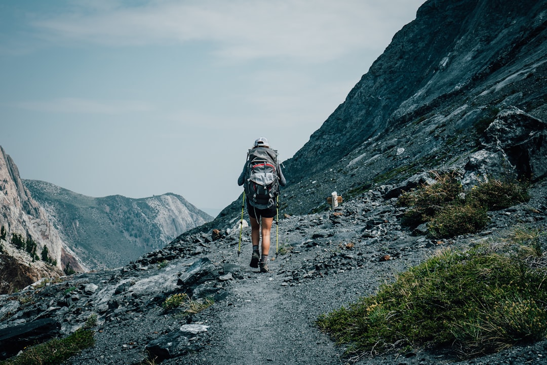
Tioga Road — the only vehicle route through Yosemite's high country — typically opens in late spring and closes with the first significant snowfall in autumn. The road climbs to Tioga Pass at just under ten thousand feet, making it the highest highway pass in California. Visitors who drive it without understanding the elevation profile sometimes stop at a pullout, step out to stretch, and realize the short walk to the overlook leaves them winded.
This isn't a fitness problem. It's a physics problem. The body needs time to adjust, and the car covers elevation faster than biology can follow.
Check current Tioga Road status through the National Park Service before planning any high-country day. Road openings vary by snowpack and can shift by weeks in either direction.
The most common elevation mistake in Yosemite isn't attempting something dangerous — it's attempting something reasonable at the wrong time in the wrong sequence. A family drives from Fresno to Tuolumne Meadows in one push, starts a hike at ten in the morning, and by two o'clock someone has a headache, someone else is nauseous, and the group is back at the car wondering what went wrong. Nothing went wrong except the order of operations.
The second most common mistake is underpacking. The Valley felt warm, so the jacket stayed in the rental. The high country doesn't negotiate.
Elevation doesn't require fear. It requires acknowledgment. The park starts higher than most people think, climbs faster than most people expect, and compounds effort in ways that flat-trail experience doesn't prepare for. Give it a day. Drink more water than feels necessary. Start early, descend before the clouds arrive, and pack for the altitude you're visiting — not the altitude you slept at.
The hikers who come back grinning from Cathedral Lakes or Gaylor Lakes or Lembert Dome aren't the fittest ones in the parking lot. They're the ones who gave their bodies a day to catch up with the car.
Elevation reference: Yosemite Valley sits near four thousand feet. Glacier Point reaches approximately seventy-two hundred feet. Tuolumne Meadows sits at roughly eighty-six hundred feet. Tioga Pass crests near ten thousand feet. Expect your body to notice the difference above eight thousand feet, especially with exertion.
Tioga Road access: Seasonal. Typically opens late May or early June and closes with the first major snowfall in autumn — dates shift year to year. Check the NPS Yosemite road status page before planning any high-country visit: nps.gov/yose/planyourvisit/conditions.htm
Weather in the high country: Summer afternoons historically bring thunderstorms to elevations above eight thousand feet. Morning starts are safer and more comfortable. Check NOAA mountain forecasts for Tuolumne Meadows before heading up.
Hydration: Carry more water than mileage suggests. The combination of altitude, dry air, and granite-reflected heat accelerates dehydration beyond what most visitors expect from the distance alone.
Layering: Pack for the elevation you're visiting. A fifteen-to-twenty-degree temperature drop between Valley and high country is typical in summer. Wind adds chill above tree line.
Acclimation window: Spending your first day at or below Valley elevation before heading to the high country reduces altitude-related symptoms for most visitors. If arriving from sea level, consider two days of gradual adjustment.
Guests staying in gateway communities like Mariposa, Groveland, or Oakhurst are already at moderate elevation — roughly two thousand to three thousand feet — which provides a gentler transition than arriving directly from sea level. Planning a Valley day before a high-country day turns the drive into built-in acclimation rather than a logistical obstacle.
Want to feature your business on the DirectStay Blog?
Want to feature your business on the DirectStay Blog?

Connect with travelers, share your space, and join a community of hosts earning together.
Become a host