

 DirectStay
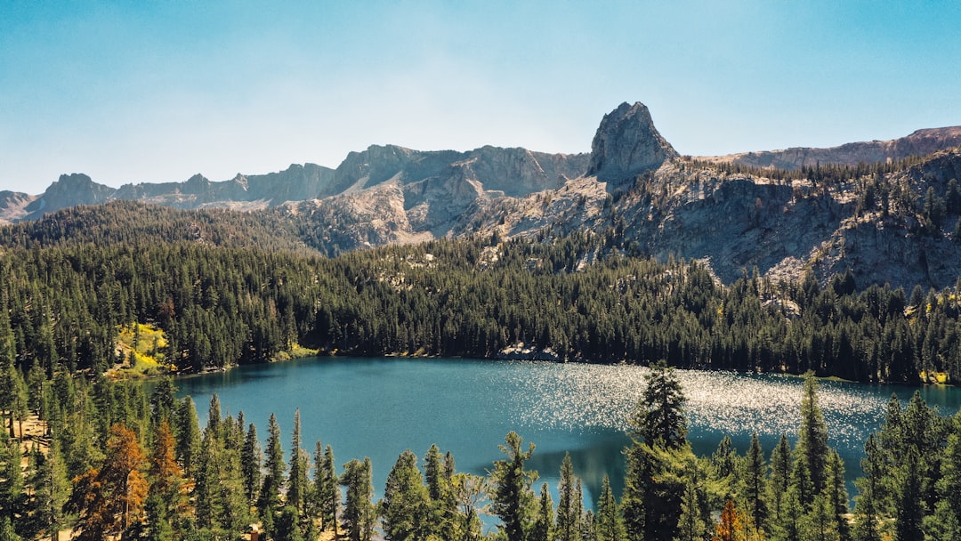
The St. Johns River widens as it moves north through Putnam County, the way rivers tend to do. But somewhere south of Georgetown, it stops widening and starts becoming something else entirely — a lake. Not a swamp lake hiding behind cypress curtains. Not a retention pond dressed up with a name. Lake George stretches eleven miles long and six miles wide, and from the center of it, the shoreline thins to a dark line against the sky. The water averages less than ten feet deep across almost its entire surface. Wind matters here. Weather moves across the lake with nothing to slow it down. And the biology beneath the hull involves species that belong in the Atlantic Ocean, not in a freshwater system fed by the state's largest north-flowing river.
The western shore of Lake George borders the Ocala National Forest, and along that boundary, springs push water into the lake from below. Silver Glen Springs, Salt Springs, and Juniper Creek all discharge into Lake George from the forest side. These aren't freshwater-only springs. The Floridan Aquifer in this region carries enough dissolved mineral content — residual salinity from an era when sea levels ran a hundred feet higher — that the spring outflows register as brackish. Atlantic tides also push saltwater upstream as far as Lake George, reinforcing what the springs introduce. That salt doesn't dissipate quickly in a lake this shallow. It accumulates. The result is an inland body of water where Atlantic stingray patrol the bottom, where striped bass feed alongside largemouth, and where blue crabs sustain a commercial fishery that shouldn't exist this far from the coast. Lake George supports one of the only freshwater blue crab fisheries in the world — not as a curiosity or an occasional catch, but as an active, harvestable population large enough to anchor the Palatka Blue Crab Festival every spring.
Most Florida lakes have vegetation. Lily pads, hydrilla mats, cattail edges — structure that breaks the water into zones and gives fish something to hide behind. Lake George historically had thousands of acres of native eelgrass in its shallows, but Hurricane Irma stripped most of it in 2017, and the lake has been slow to recover. Restoration efforts are underway — the Florida Fish and Wildlife Conservation Commission planted more than fifty thousand eelgrass starts in 2022 — but for now, the bottom remains broad, flat, and largely featureless outside of a navigation channel running from the southern jetties where the St. Johns enters to the northern outlet at Rocky Point. For anglers, this means traditional structure-fishing instincts don't apply here. Largemouth bass relate to pilings, the jetty walls, and the scattered shell beds along the western shore where spring outflows meet the lake. For boaters, it means the lake behaves more like open ocean than a protected inland waterway. Wind builds across six uninterrupted miles of fetch. A calm morning can turn into a rough afternoon with little warning. The lake's shallow depth amplifies chop — short, steep waves that a deeper lake would absorb.
Check marine weather before launching. This isn't a suggestion made out of caution. It's the primary planning variable that separates a good day on Lake George from a genuinely dangerous one.
Georgetown sits at the northeastern corner of the lake and functions as the primary access town. Georgetown Marina, at 1533 County Road 309, is the full-service entry point — boat ramp, non-ethanol fuel, bait and tackle, and the kind of local fishing intelligence that comes from sitting at the same dock since 1960. The marina operates Monday through Wednesday from 7:00 AM to 2:00 PM and Thursday through Sunday from 7:00 AM to 5:00 PM. It is the primary staging point for guided trips and recreational launches on the Putnam County side.
On the Volusia County side, public access runs through the Lake George State Forest boat ramp off Highway 40, and Pine Island Fish Camp offers private access on the eastern shore. The western shore belongs almost entirely to the Ocala National Forest, where spring recreation areas — Silver Glen, Salt Springs — double as launch corridors for paddlers willing to work from spring run into open lake.
For those approaching from the south, Fort Gates Ferry crosses the St. Johns River just downstream of the lake. The ferry has been running since 1853 — the oldest operating ferry in Florida — and it saves roughly fifty miles of driving versus going around through Palatka or Astor. The crossing takes ten minutes, costs ten dollars per vehicle, and operates daily except Tuesday from 8:00 AM to 5:30 PM. The forest road to the western landing can be rough — sandy, rutted, occasionally muddy after rain. High-clearance vehicles are recommended on the Ocala National Forest side.
The Lake George area supports one of the densest concentrations of nesting bald eagles in Florida — which itself ranks among the densest states in the lower forty-eight. Osprey hunt the surface year-round. Alligators inhabit every margin. The Lake George Conservation Area and Wildlife Management Area together protect more than eight thousand acres along the eastern and southern shores, connecting pine flatwoods and cypress swamp into a contiguous corridor along the St. Johns River.
In winter, manatees follow warm spring outflows from the Ocala National Forest side, congregating where Silver Glen and Salt Springs discharge into the lake. This is the same thermal logic that draws manatees to Blue Spring State Park farther south on the St. Johns — they go where the water stays warm. On Lake George, that means the western shore becomes seasonal viewing territory for anyone paddling or anchoring near the spring mouths.
The Pinecastle Bombing Range, a remnant of World War II-era military operations, still functions under Naval Air Station Jacksonville on the lake's western edge. Active military use continues in designated zones within the Ocala National Forest. Boaters should be aware of restricted areas marked on navigation charts.
Lake George doesn't offer the intimacy of a spring run or the contained beauty of a creek corridor. It offers scale. The kind of water where the horizon line is the only reference point and your boat becomes very small. The springs feed in from the west. The river exits to the north. The fish that shouldn't be here — crabs, stingrays, striped bass — are here because geology left a salt signature in the aquifer that no amount of freshwater flow has erased.
Whether you come for the bass fishing, the blue crabs, the eagle-watching, or simply to understand why everything on this stretch of the St. Johns eventually orbits the same forty-six thousand acres of open water, the answer to what draws you here is the same answer the river gives: it depends on what you're looking for, and the lake is large enough to hold all of it.
Want to feature your business on the DirectStay Blog?
Want to feature your business on the DirectStay Blog?

Connect with travelers, share your space, and join a community of hosts earning together.
Become a host