

 DirectStay
Most people who cross Donner Pass do it at freeway speed — granite walls blurring past at sixty-five, a road sign mentioning elevation, and then the descent toward Truckee begins. That version of the pass is transit. It gets you somewhere else. But Donner Pass Road — the old highway that predates the interstate — doesn't behave like a through-route. It climbs differently. The grade tightens. The pavement narrows past rock faces where climbers chalk their hands on summer mornings. Somewhere near the Rainbow Bridge overlook, the windshield frames Donner Lake a thousand feet below, and what started as a shortcut becomes the reason you pulled over. Then there's Donner Memorial State Park, where the road stops mattering altogether. The trails here carry weight that has nothing to do with scenery — pioneer monuments, interpretive paths along the lakeshore, and a visitor center built around the question of what it cost to cross these mountains in the first place.
The stretch of Old Highway 40 between Donner Lake and Donner Summit is the part most people mean when they say "Donner Pass." The road itself was the primary route across the northern Sierra Nevada before Interstate 80 replaced it in the early 1960s. What remains is a two-lane road that follows the original Lincoln Highway alignment — the first automobile road to cross the United States, dedicated in 1913.
The experience changes depending on whether you treat it as a drive or a series of stops.
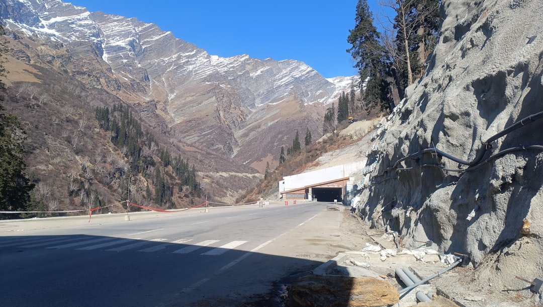
As a drive, the road rewards attention. Granite walls rise on one side. The grade climbs steadily through terrain shaped by rail construction, wagon routes, and ice. The Rainbow Bridge — a concrete arch built in the 1920s — spans a granite gorge and puts Donner Lake directly below. Most visitors stop here, take a photograph, and get back in the car. The windshield version of Donner Pass takes under thirty minutes from Truckee.
As a walking corridor, it asks for more time. The Donner Summit Historical Society maintains what it calls the 20 Mile Museum — a series of interpretive signs placed along the old highway route, covering everything from Washoe petroglyphs to railroad tunnel construction to the Lincoln Highway's role in binding the country by automobile. The signs don't cluster in one location. They're spread across the road's full length, which means you stop, read, drive a quarter mile, and stop again.
This is the distinction the blog is built around: you can see Donner Pass through a windshield in one pass, or you can stop repeatedly and discover that the road itself is the exhibit.
Donner Memorial State Park sits at the eastern end of Donner Lake, within the town of Truckee. It operates year-round, though campground access and water-based activities are seasonal — typically Memorial Day through mid-September.
The visitor center is the anchor. Opened in 2015, it replaced the older Emigrant Trail Museum with a larger facility containing exhibits on the Washoe people, the Donner Party, the transcontinental railroad's construction by Chinese laborers, and the highway era that followed. The exhibits work because they layer rather than isolate — the same geography that trapped a wagon party in 1846 became the corridor for rail, road, and eventually interstate.
Outside, the Pioneer Monument marks the approximate site of the Schallenberger/Breen cabin, with a bronze statue that was, at the time of its construction, said to be the largest west of the Mississippi.
Lakeside Interpretive Trail — A flat, accessible path that follows Donner Lake's southern shore for about a mile and a half, with educational panels on local ecology. Stroller-friendly. Dog-friendly on leash.
Nature Trail — A half-mile loop through forest and along creekside boardwalks near the historic Murphy Cabin site. Flat, accessible, and short enough for young children.
Splitrock Trail — A moderate two-mile loop with some elevation gain. Quieter than the lakeshore routes. Open to hikers and mountain bikers.
The test for whether to stop at the park is simple: do you want to understand the pass, or just see it? The museum and trails answer different versions of that question, but they both require getting out of the car.
The windshield version of Donner Pass is scenic. Legitimately so. The lake view from Rainbow Bridge is one of the most photographed vistas in the northern Sierra, and the drive through granite cuts carries its own weight.
But the corridor rewards the person who stops — repeatedly, and with patience.
The petroglyphs near Donner Summit — carved into granite by the Martis Culture, possibly ancestors of the Washoe people, somewhere between 1,500 and 4,000 years ago — sit on a flat rock bench just off Donner Pass Road between the Rainbow Bridge and the China Wall. A roadside pullout and a 20 Mile Museum sign mark the spot. A low border of stacked rocks guides foot traffic around the carvings, and a kiosk orients visitors to what they're looking at. There are no fences, no admission, no formal barriers. The petroglyphs are faint — you have to move around them, catch the angle of light, and look carefully. Drive past at speed and you'll never know they were there.
The old railroad tunnels — particularly Tunnel 6, the longest of the original Central Pacific crossings, completed in 1867 — are accessible on foot from dirt pullouts along Donner Pass Road near the summit. There are no official trailhead signs; you park at a pullout and scramble up granite to reach the tunnel entrances. The tunnels sit on private property owned by Union Pacific Railroad, though no fences or signage restrict access, and hikers have walked them freely for decades. Bring a flashlight — Tunnel 6 is dark, wet, and long. The walls are tagged with graffiti now, but the engineering scale is still legible: hand-drilled granite, blasted through by hundreds of Chinese workers across multiple Sierra winters.
The 20 Mile Museum signs, the petroglyphs, the tunnel, the monument — none of these work at freeway speed. They accumulate, and the accumulation is the point.
Where: Donner Pass Road (also called Old Highway 40) begins in Truckee and climbs west to Donner Summit. Donner Memorial State Park is at 12593 Donner Pass Road, Truckee, CA 96161. The park sits at the eastern end of Donner Lake, just west of downtown Truckee off I-80.
Donner Pass Road access: The road generally stays open year-round, though heavy snowfall can close it temporarily. Chain restrictions near ski areas are not uncommon in winter. Check Caltrans road conditions before heading up in winter months: dot.ca.gov/travel.
Park hours: Donner Memorial State Park is open year-round. The visitor center has historically operated daily, with seasonal adjustments to hours. Confirm current hours and any closures at parks.ca.gov/DonnerMemorial.
Parking: Day-use parking fees apply at the state park. Current rates and seasonal passes: parks.ca.gov. The Rainbow Bridge overlook on Donner Pass Road has roadside pullout parking — no fee, but limited space.
Trail conditions: Trail accessibility and seasonal closures vary. The Lakeside Interpretive Trail and Nature Trail are typically accessible year-round, though snow cover affects winter conditions. Current trail status: parks.ca.gov/DonnerMemorial.
Dogs: Welcome on leash (six-foot max) on the Lakeside Interpretive Trail, fire roads, and much of Donner Lake's shoreline. Not permitted on China Cove Beach.
20 Mile Museum: The interpretive signs along Old Highway 40 are free, self-guided, and always accessible — they're roadside installations. A downloadable brochure with sign locations is available through the Donner Summit Historical Society.
Time commitment: The drive from Truckee to Donner Summit and back takes under an hour without stops. Add the park's visitor center and one trail, and the day stretches to three or four hours. Add the 20 Mile Museum stops, and you'll fill a full half-day.
This corridor is a natural half-day addition to any Truckee-area stay. Guests who plan ahead and build the drive into a full morning or afternoon — rather than squeezing it between other commitments — get the most from the stops. The park's proximity to downtown Truckee makes it easy to pair with dining or errands before heading back.
A thousand feet of granite, a lake, a road older than the interstate, and a story older than the road. Donner Pass gives you exactly as much as you're willing to slow down for. Drive it in twenty minutes and you'll remember the view from Rainbow Bridge. Walk the trails, read the signs, step inside the tunnel — and you'll remember why anyone tried to cross these mountains in the first place. The car gets you there. Your feet tell you what happened.
Want to feature your business on the DirectStay Blog?
Want to feature your business on the DirectStay Blog?

Connect with travelers, share your space, and join a community of hosts earning together.
Become a host