

 DirectStay
A hike near North Lake Tahoe comes with a question most people skip past: how much of the reward do you want to earn? There's a pull-off on Highway 89 where the trail to Eagle Rock disappears into pines and delivers a full-lake panorama in under twenty minutes — the kind of view that makes first-timers stop talking mid-sentence. Most hikers default to that math. Short trail, huge payoff, back to the car before lunch. And honestly, the math works. But deeper in the same range, where the trails lengthen and the elevation stacks, the thing that shifts isn't just the view — it's what you bring back from it. A ridge on the Tahoe Rim Trail earned over hours of climbing through fir and volcanic terrain, or a basin inside Granite Chief Wilderness reached after a steep push past tree line, returns something that no overlook parking lot ever hands you.
The trail starts from a small gravel pullout on the west shore, between Tahoe City and Homewood. There's room for maybe a dozen cars, and during summer weekends it fills before mid-morning. The hike itself is less than a mile round trip, with roughly 250 feet of elevation gain — manageable for families with small children and for anyone who hasn't hiked in months.
The first few minutes move through a gradually sloping forest, quiet and shaded, the kind of walk that doesn't register as a hike. Then the trail steepens, shifts from packed dirt to volcanic rock, and the footing gets uneven. The final push to the summit involves scrambling over boulders — nothing technical, but enough to make you pay attention to where you step.
At the top, the reward arrives all at once. Eagle Rock sits at 6,286 feet, and the east-facing view opens across nearly the full breadth of Lake Tahoe. The water stretches below the tree line, the Carson Range runs along the far shore, and on a clear morning the depth of the blue is difficult to describe without reaching for words that sound exaggerated. The summit is a rocky tabletop, uneven and exposed to wind, and it holds maybe thirty people comfortably before it starts feeling crowded.
The California Tahoe Conservancy rebuilt the trail in 2011 to stabilize severe erosion from decades of user-created routes. The current path is well-defined through the forest but becomes less obvious near the top. Peregrine falcons nest in the area — hikers have reported seeing them circling the summit.
This is the hike that works when you have forty-five minutes, when the kids are with you, when you didn't pack enough water for anything longer. The view-to-effort ratio is as compressed as it gets in the Tahoe basin.
The Tahoe Rim Trail circles the entire lake — 165 miles of single-track threading through two states, six counties, and three wilderness areas. Most visitors will never thru-hike it. But the sections accessible from North Lake Tahoe are among the most varied, and even a day hike on the TRT changes the relationship between effort and landscape.
The segment between Tahoe City and Brockway Summit runs roughly 20 miles, climbing through groves of fir, cedar, and aspen, crossing open hillsides thick with manzanita. Side trails branch toward cinder cones and ancient lava flows — geological evidence that this terrain was built by fire, not just ice. Midway through, the forest thickens and quiets. The trail passes the Lava Cliffs, a lookout above the lake and the peaks lining its north shore, before dropping to Watson Lake, a shallow basin fringed with wildflowers in early summer.
What changes over distance isn't the scenery alone. It's the pace of noticing. On a short hike, the view is the destination — you arrive, take it in, turn around. On a longer stretch of the TRT, the views accumulate. A meadow you'd walk past in fifteen minutes becomes the place you eat lunch, check the map, listen to the wind cross the ridge. The trail earns its reputation not through any single vista but through the slow stacking of terrain.
The Tahoe Rim Trail Association maintains the trail and publishes current conditions. Snow lingers at elevation well into early summer — some years, sections above 8,000 feet aren't clear until mid-July. Afternoon thunderstorms are common in summer months, especially on exposed ridges. The trail is open to hikers, equestrians, and mountain bikers in most sections.
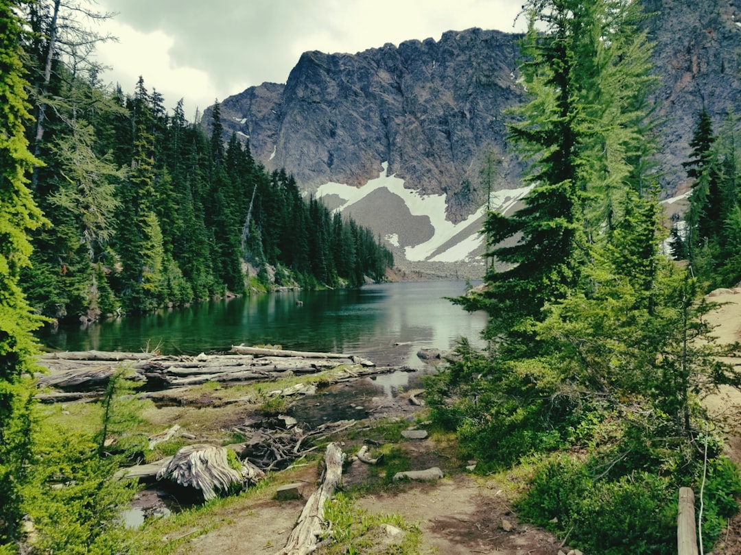
Past the resort infrastructure of Olympic Valley, the trail system enters Granite Chief Wilderness — roughly 28,000 acres of glacier-carved valleys, exposed granite, and meadows that see far less foot traffic than the lakeside paths.
The most accessible entry is Five Lakes Trail, a roughly 4.6-mile round trip with about 1,000 feet of elevation gain. The trail climbs through pine forest to a high-altitude basin holding a cluster of alpine lakes. It's the most visited destination in the wilderness, popular enough that parking at the trailhead fills on summer weekends. But the crowds thin quickly past the lakes.
Beyond Five Lakes, the wilderness opens. The Pacific Crest Trail runs for 21 miles along the eastern boundary. The Granite Chief Trail itself — starting from Olympic Valley — gains roughly 2,500 to 2,800 feet over five-plus miles through rock gardens, creek crossings, and terrain that changes color with every switchback. The summit of Granite Chief reaches 9,019 feet. The Western States Endurance Run and the Tevis Cup equestrian ride both cross this ground, which says something about what the terrain asks of the body.
Dogs are prohibited from May 15 through July 15 in designated deer fawning areas within the wilderness. Group size is limited to 12, and camping within 600 feet of any lake in the Five Lakes basin is not allowed. These aren't inconveniences — they're the reason the place still feels the way it does.
The reward here isn't a single view. It's the accumulation of distance, the quiet that sets in after the first hour, and the understanding that the landscape doesn't compress its value into a summit photo. You carry it out in your legs.
The real fork in North Lake Tahoe hiking isn't distance or difficulty. It's what you're after when you lace up. A compressed reward, handed to you in exchange for a short steep push — or a slow accumulation of ground, earned over hours, where the view is almost beside the point by the time you reach it.
Eagle Rock proves that effort and payoff don't have to scale together. The Tahoe Rim Trail proves they can. Granite Chief Wilderness proves that sometimes the payoff isn't the view at all — it's the silence after the last switchback, when you realize you haven't heard a car in two hours.
None of these is the right hike. All of them are the right hike for someone on a specific morning with a specific amount of time and a specific appetite for what the mountains ask in return.
Trailhead: Off Highway 89 (West Lake Boulevard), in Tahoe Pines between Tahoe City and Homewood. Small gravel pullout — room for approximately 12–15 vehicles. No restrooms at the trailhead.
Distance/Difficulty: Approximately 0.7–0.8 miles round trip, 250 feet elevation gain. Generally rated easy to moderate — the final summit scramble over volcanic rock is the most challenging section.
Dogs: Allowed on leash.
Conditions: The trail is open year-round, though winter access may require microspikes or snowshoes. Summit is exposed and windy. Check conditions at the Lake Tahoe Basin Management Unit site before heading out: fs.usda.gov/recmain/ltbmu/recreation
Tahoe Rim Trail (North Sections)
Trailhead access (Tahoe City): The TRT is accessible from multiple trailheads around the lake. The Tahoe City trailhead connects to the Tahoe City–Brockway Summit segment.
Distance: 165 miles total (full loop). Day hike sections range from short out-and-backs to full-day segments of 10+ miles.
Season: Typically snow-free from mid-July through mid-October, depending on snowpack year. Afternoon thunderstorms are common in summer, particularly on exposed ridges above 8,000 feet.
Conditions and planning: The Tahoe Rim Trail Association publishes current trail conditions, maps, and segment-by-segment planning resources: tahoerimtrail.org
Primary access — Five Lakes Trail: Trailhead on Alpine Meadows Road, near its intersection with Deer Park Drive, close to Olympic Valley. Roadside parking, but fills on summer weekends.
Distance/Difficulty: Five Lakes Trail is approximately 4.6 miles round trip with ~1,000 feet elevation gain. Granite Chief summit via the Granite Chief Trail from Olympic Valley is a strenuous full-day hike — sources report distances between 6.5 and 11.2 miles round trip with 2,000–2,850 feet of gain, depending on route variation and measurement method. Confirm current route information before attempting.
Permits: No wilderness permit required for day hiking or backpacking. A valid fire permit is required for stove use on National Forest land.
Dog restrictions: Dogs prohibited May 15–July 15 in designated deer fawning areas within the wilderness (French Meadows Game Refuge portion and Big Springs Trail corridor). Check current regulations before bringing dogs.
Group size limit: 12 people for day and overnight use.
Conditions: Managed by Tahoe National Forest. Trail conditions vary by season — some trails are overgrown in less-used areas. Confirm current access at the USDA Forest Service site: fs.usda.gov/recarea/ltbmu/recarea/?recid=11819
Lodging note: Hikers staying in North Lake Tahoe vacation rentals have the advantage of proximity to multiple trailheads without competing for day-use parking at peak hours. An early-morning start from a rental near Tahoe City or Olympic Valley puts you at the trailhead before the lots fill.
Three trails. Three versions of the same exchange between your body and the terrain it crosses. The twenty-minute scramble that hands you the whole lake. The ridgeline that teaches you what patience looks like at 8,000 feet. The wilderness that doesn't hand you anything — it just gets quieter until you stop keeping track.
North Lake Tahoe doesn't ask which one is better. It asks which one matches the morning you woke up with.
Want to feature your business on the DirectStay Blog?
Want to feature your business on the DirectStay Blog?

Connect with travelers, share your space, and join a community of hosts earning together.
Become a host