

 DirectStay
The Great Smokies reward people who never leave the car. Newfound Gap Road crosses the spine of the Appalachians on a paved two-lane that climbs from river-bottom forest into clouds — and every major overlook sits within steps of where you stop. You idle at elevation, watch ridgelines dissolve into haze, and realize the park was built for windshields as much as boot soles. But not every scenic drive here stays inside the park boundary. There's another route that starts at the Cherokee entrance and threads onto the Blue Ridge Parkway — where the road itself becomes the destination, the ridgelines keep unfolding, and the Smokies shrink in your mirror while something bigger opens ahead. One drive immerses you in the park. The other connects you through it.
Three roads inside Great Smoky Mountains National Park were designed for the driver who wants to stay close to the landscape without strapping on a pack.
The park's only road that crosses the full ridge, connecting Gatlinburg on the Tennessee side to Cherokee on the North Carolina side. It runs roughly thirty-three miles and gains more than three thousand feet of elevation in the process. The pavement does the climbing — you just steer.
What makes this route work for non-hikers: the overlooks are the experience, not the consolation prize. At lower elevations, the road traces the West Prong of the Little Pigeon River through cove hardwood forest. By mid-climb, the canopy shifts — birch and spruce replace oak and tulip poplar, and the temperature can drop ten to fifteen degrees from the base. At Newfound Gap itself, you stand on the state line at over five thousand feet with views that reach into both states on a clear morning.
The road passes two visitor centers — Sugarlands near Gatlinburg and Oconaluftee near Cherokee — where exhibits, restrooms, and ranger talks are fully accessible without trail exposure. Between them, a series of signed pullouts let you photograph the layered ridgeline effect the park is named for.
If Kuwohi Road is open (typically April through November), a seven-mile spur climbs to Kuwohi — the park's highest point at 6,643 feet, restored to its Cherokee name in 2024. The observation tower at the summit sits at the end of a steep half-mile paved path — manageable for many, though the grade is real. On a clear day, the view from the top reaches into seven states.
The rhythm: Expect two to four hours with stops. The road carries steady traffic in peak season, but movement rarely stalls the way Cades Cove does. Mornings before ten tend to run smoother.
Eleven miles of one-way valley road encircling an open grassland ringed by mountains. The loop is covered in depth in the Cades Cove wildlife guide [Blog #21], but for non-hikers the draw is different here: it's the churches, homesteads, and working gristmill that punctuate the drive, each one visible from the road or a few flat steps away.
The pace of Cades Cove is not your decision. During peak hours — roughly ten in the morning through midafternoon — the loop slows to a crawl as vehicles stop for deer, turkey, and the occasional black bear grazing in the fields. Arriving before eight or after five changes the experience entirely. Early mornings bring fog in the valley and wildlife in the open grass. Late afternoons bring long shadows and a fraction of the cars.
Cable Mill, roughly halfway around the loop, is the one spot worth parking for. The working gristmill, blacksmith shop, and cantilever barn sit in a flat cluster accessible without steep terrain.
The rhythm: Budget ninety minutes on an uncrowded morning. Budget four-plus hours during midday peak season. There is no shortcut out until the Hyatt Lane cutoff roughly a third of the way through, and one more at Sparks Lane near the midpoint.
A narrow, winding, one-way loop accessed from Gatlinburg. Five and a half miles through old-growth forest, past preserved log cabins and a roadside waterfall. The road is tight — no RVs or trailers allowed — and the canopy closes over the pavement in a way that makes the drive feel like entering a tunnel built by trees.
The key stop for non-hikers: the Place of a Thousand Drips, a curtain of water that cascades across a rock face directly beside the pavement during wet seasons. You don't walk to it. You park next to it. The Ephraim Bales cabin — a dogtrot homestead where a family of eleven once lived — sits just off the road behind a small pullout and takes only a few steps to reach.
The rhythm: Forty-five minutes to an hour. Road is seasonal — typically open April through late November. No services, no restrooms, no cell service on the loop.
Two routes begin at or near the park's edges and carry you into a broader Appalachian landscape. The Smokies become the starting point rather than the container.
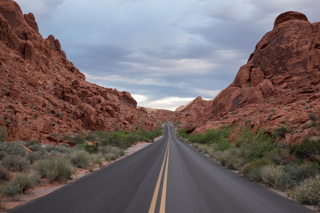
The parkway meets Great Smoky Mountains National Park at its southern terminus, Mile 469, near the Oconaluftee Visitor Center in Cherokee. From there, it heads northeast toward Asheville and beyond — a road with no commercial traffic, no stoplights, and no intersections for as far as you care to drive.
For non-hikers, the parkway works because it was designed as a driving experience. Every overlook is engineered: stone walls, paved pullouts, interpretive plaques, elevation markers. The road follows ridgelines rather than crossing them, so the views stay lateral — long valleys opening to one side, then the other, as the route bends.
From Cherokee, the first forty-five miles northbound carry you through some of the parkway's highest elevations. Waterrock Knob (Mile 451) sits at 6,292 feet — the visitor center parking area alone, at nearly 6,000 feet, delivers sweeping views east and west without leaving the car. A steep 1.2-mile round-trip trail climbs to the summit for a wider panorama, but the parking lot views satisfy most non-hikers. Richland Balsam (Mile 431) is the highest point on the entire parkway at 6,053 feet — you feel the elevation in the thin air and the spruce-fir forest around you, a landscape that exists in the Southern Appalachians only above five thousand feet.
The difference from Newfound Gap Road: no destination. No far-side town to reach. You drive until the road asks more than you want to give, then turn around or exit onto a connecting highway. The parkway rewards aimlessness in a way park-interior roads, with their loop structures and endpoint logic, do not.
The rhythm: Budget a full day if driving to Asheville (roughly two and a half hours without stops, five-plus with overlooks). Or drive an hour, turn around, and let the return trip show you everything you saw from the other direction.
Less known and far less crowded. The Foothills Parkway's western section now runs thirty-three continuous miles from Chilhowee to Wears Valley along a ridge above the park's northern boundary. The road sits higher than the park, looking down into it — a reversal of perspective that most visitors never find because it doesn't appear on the typical Gatlinburg-centric itinerary.
Look Rock, the anchor stop on this stretch, has an observation tower accessible via a half-mile paved trail with moderate inclines. The grade is steeper than it looks — not flat — but the distance is short and the payoff is a 360-degree view that puts the entire western Smokies below you: Cades Cove's valley, the ridgelines layering south toward North Carolina, and on clear days, the Tennessee Valley stretching north toward Knoxville.
The "Missing Link" section — a 1.6-mile stretch of bridges spanning steep mountain gaps that took decades to complete — opened in November 2018, finally connecting the full route. This section carries far less traffic than any park-interior road.
The rhythm: The western section takes roughly an hour. Combine it with a Cades Cove morning for a full day that stays on the Tennessee side without repeating any road.
The choice comes down to containment or expansion.
Park-interior drives — Newfound Gap Road, Cades Cove, Roaring Fork — keep you inside the boundary. The forest is close. The overlooks face inward. You see the park from the park, and every stop reinforces where you are. If your group wants immersion — the feeling of being surrounded by the Smokies — these roads deliver it without a single trail.
Parkway drives — the Blue Ridge Parkway, the Foothills Parkway — pull you to the edges and beyond. The views are longer. The forest falls away in places. You see the Smokies in context: how they sit against the rest of southern Appalachia, how the elevation shapes what grows where, how the park is one piece of a much larger system. If your group wants perspective — the kind of understanding that only comes from distance — these roads deliver it while the car does the work.
Most non-hikers don't realize they have this choice. The park brochures emphasize trails. The scenic drive content tends to lump everything together. But the experience of staying inside the park for a day and the experience of threading along its edge for a day are fundamentally different trips — and knowing which one suits your group before you turn the key saves a full day of wrong-tempo driving.
Great Smoky Mountains National Park spans the Tennessee–North Carolina border. The scenic drives in this guide are accessed from Gatlinburg, TN (Newfound Gap Road, Roaring Fork), Townsend, TN (Cades Cove, Foothills Parkway), and Cherokee, NC (Blue Ridge Parkway, Newfound Gap Road's southern end).
Pullouts along Newfound Gap Road and the Blue Ridge Parkway accommodate standard vehicles. Cades Cove has designated lots at Cable Mill and several trailhead areas. Roaring Fork prohibits RVs and trailers. The Foothills Parkway has small lots at Look Rock and the new overlook spans.
Great Smoky Mountains National Park does not charge an entrance fee. A parking tag is required for vehicles stopping within the park — verify current pricing and structure at nps.gov/grsm.
Roaring Fork Motor Nature Trail and Kuwohi Road close seasonally, typically late November through March. The Blue Ridge Parkway closes sections during winter weather and can close with little notice at high elevations. Check current road status at nps.gov/grsm (park roads) and nps.gov/blri (parkway).
Sugarlands and Oconaluftee visitor centers are fully wheelchair accessible. Most overlook pullouts along Newfound Gap Road and the Blue Ridge Parkway are paved and accessible from the parking surface. The Kuwohi observation tower path is paved but steep — the grade exceeds 12 percent. Cable Mill area in Cades Cove is mostly flat and accessible. Confirm current accessibility details at nps.gov/grsm/planyourvisit/accessibility.htm.
Fill up before entering the park — no gas stations exist inside park boundaries. Gatlinburg and Cherokee are the nearest full-service towns for the Newfound Gap corridor. Townsend serves the Cades Cove and Foothills Parkway routes. The Blue Ridge Parkway has no fuel between Cherokee and Asheville — budget accordingly.
Available at Sugarlands Visitor Center, Oconaluftee Visitor Center, Cades Cove picnic area, and Cable Mill. On Roaring Fork, restrooms are available at the Rainbow Falls and Grotto Falls trailhead parking areas but not elsewhere along the loop. Blue Ridge Parkway restrooms are located at select overlooks and visitor centers — Waterrock Knob has seasonal facilities.
These drives work as full-day excursions from a base anywhere in the gateway towns. Arriving early — before the park's peak traffic window — means the drive home becomes the decompression, not the obstacle.
One drive puts the mountains around you. The other puts them behind you, then beside you, then below you. The Great Smokies built roads for people who came to look, not to walk — and the only question is whether you want to look inward at the park or outward from it. Either way, the windshield earns its keep.
Want to feature your business on the DirectStay Blog?
Want to feature your business on the DirectStay Blog?

Connect with travelers, share your space, and join a community of hosts earning together.
Become a host