

 DirectStay
Most visitors to the Great Smoky Mountains assume the best of the park belongs to people who lace up boots and earn their views on foot. That assumption holds until someone drives Newfound Gap Road for the first time and watches the forest change around them in thirty minutes — cove hardwood giving way to oak, then to spruce — through nothing but a windshield and an open window. The Smokies have always rewarded drivers as generously as hikers. But there is a fork in that reward, and it matters which direction you choose. One route keeps you inside the park all day, climbing through its center until you're standing on the state line between Tennessee and North Carolina. The other pulls you along ridgelines that run parallel to the boundary, where the mountains unfold sideways instead of straight ahead. Both are drivable in a single day. Both accommodate passengers who never leave their seat. They answer the same question — how do I see this place without a trail — and the answer depends on whether the park is your destination or starting point.
When the goal is immersion — spending an entire day surrounded by Great Smoky Mountains National Park without setting foot on a trail — three roads deliver that experience at three different speeds.
This is the only road that crosses the park's full width. It runs roughly 31 miles from the Sugarlands Visitor Center near Gatlinburg, Tennessee, to the Oconaluftee Visitor Center near Cherokee, North Carolina, climbing approximately 3,000 feet along the way. The road passes through multiple forest ecosystems as it ascends — cove hardwood at the base, pine-oak forests in the mid-elevations, and spruce-fir near the top. Newfound Gap itself sits at just above 5,000 feet, where a large parking area straddles the Tennessee–North Carolina state line. This is where President Franklin D. Roosevelt dedicated the park in 1940. The Rockefeller Memorial marks the spot.
Key stops that require no hiking: Campbell Overlook (a few miles south of Sugarlands Visitor Center, with views of Mount LeConte at 6,593 feet), Newfound Gap Overlook (mile 14.7), the Oconaluftee Visitor Center and Mountain Farm Museum at the southern end. At Newfound Gap, the turnoff for Kuwohi Road leads seven miles to the parking area near the park's highest point — though the half-mile walk to the observation tower, while paved, is steep enough to count as effort.
Driving Newfound Gap Road straight through takes about an hour. With stops, plan for two to four hours. The road stays open year-round, though winter closures happen during and after storms. No chemicals are used for snow removal inside the park — only plows and gravel — so conditions above 4,000 feet can deteriorate quickly.
Eleven miles, one lane, one direction. Cades Cove is the park's most visited single area, and its loop road moves at a pace that has more in common with a walking speed than a driving speed. Wildlife pauses traffic. Visitors stop at historic cabins, churches, and cemeteries scattered through a wide valley surrounded by mountains. The experience is less about elevation and overlooks and more about looking out across open fields and imagining the families who farmed this valley before the park existed.
For non-hikers, the stops are almost entirely car-accessible: the John Oliver Cabin, Primitive Baptist Church, Methodist Church, and Cable Mill Historic Area (roughly halfway around the loop) all sit within a short walk of the road. The valley floor is flat. What Cades Cove asks is patience, not fitness. Allow two to four hours, more during peak season when the loop can slow to a crawl. During summer months, the road is typically closed to motor vehicles on Wednesdays for cyclists and pedestrians — check the NPS schedule for current dates before planning around it.
The shortest and most seasonal of the three. This five-and-a-half-mile one-way loop near Gatlinburg is typically open from early to mid-April through November. The road is narrow, canopied, and winding — a sensory contrast to Newfound Gap's long mountain views. Here the forest presses close. Historic homesteads sit within sight of the road, and the Noah "Bud" Ogle farmstead — an authentic mountain homestead with a hand-hewn log cabin and tub mill — stands along Cherokee Orchard Road just before the one-way loop begins. Waterfalls, including the trailhead for Grotto Falls, are accessible from pullouts along the route, though the falls themselves require walking.
For someone who wants to feel the density of the Smokies — the humidity, the rhododendron corridors, the sound of water moving through rock — without committing to a trail, Roaring Fork delivers that from behind the wheel. Plan an hour. The loop is one-way: you enter from Cherokee Orchard Road and exit back onto it at the other end.
When the goal is perspective — seeing the Smokies as a range rather than a forest — two routes pull back far enough to let the full silhouette appear.
This is the drive that locals mention before tourists discover it. The completed western section stretches approximately 33 miles along the spine of Chilhowee Mountain, from the Chilhowee Lake area near US-129 to Wears Valley, running parallel to the park's northern boundary. It is technically part of the National Park Service system but physically separated from the main park roads, which keeps traffic lower than anything inside the park proper.
The road includes more than 30 pull-offs and scenic overlooks. The southeastern overlooks face directly into the Smokies — views of Cades Cove Mountain, Thunderhead Mountain, and on clear days, Kuwohi itself. The northwestern overlooks look out over the Tennessee Valley toward the Cumberland Plateau. Look Rock, at 2,650 feet, is the high point of the western section. A lower overlook sits adjacent to the parking area (accessible without walking), and a half-mile trail leads up to an observation tower with a full 360-degree view that includes some of the park's highest peaks.
The 2018 completion of the "Missing Link" — a 1.65-mile section that required bridges across ravines and decades of engineering work — connected the previously separated segments into one continuous drive. That bridge section, which feels like driving along a ridgeline suspended in air, has become a destination in its own right.
Driving the full western section takes roughly an hour without stops. With overlook stops, allow two to three hours. Note: the only public restrooms on the Foothills Parkway are at Look Rock Picnic Area. Plan accordingly.
The Blue Ridge Parkway's 469-mile run from Virginia to North Carolina terminates at the doorstep of the Smokies — Milepost 469 sits near the Oconaluftee Visitor Center in Cherokee, where it meets US-441 / Newfound Gap Road. For visitors based on the North Carolina side, the Parkway heading north offers a half-day or full-day drive that connects the park to an entirely different mountain experience.
The first 26 miles from Cherokee to Balsam Gap (Milepost 443) pass through high-ridge terrain with overlooks that face outward from the Smokies rather than into them. Waterrock Knob (Milepost 451), about 18 miles north of Cherokee, includes a visitor information center, restroom facilities, and a summit view that approaches 360 degrees. Continue another 12 miles past Balsam Gap and you reach Richland Balsam Overlook (Milepost 431), at over 6,000 feet — the highest point on the entire Blue Ridge Parkway.
The Parkway's speed limit tops out at 45 mph, dropping to 25 in curves. There are no gas stations, and dining is extremely limited. Sections can close due to weather, especially in winter and spring; checking current conditions before departure is non-negotiable. But for a non-hiker who has already driven through the Smokies and wants to understand the larger mountain system the park sits within, the Blue Ridge Parkway heading north from Cherokee is where that understanding arrives through the windshield.
The park-focused drives (Newfound Gap Road, Cades Cove, Roaring Fork) keep you surrounded. The forest is close, the elevation changes are felt through your ears, and the stops are historical and ecological. You are inside the park, absorbing it from the interior.
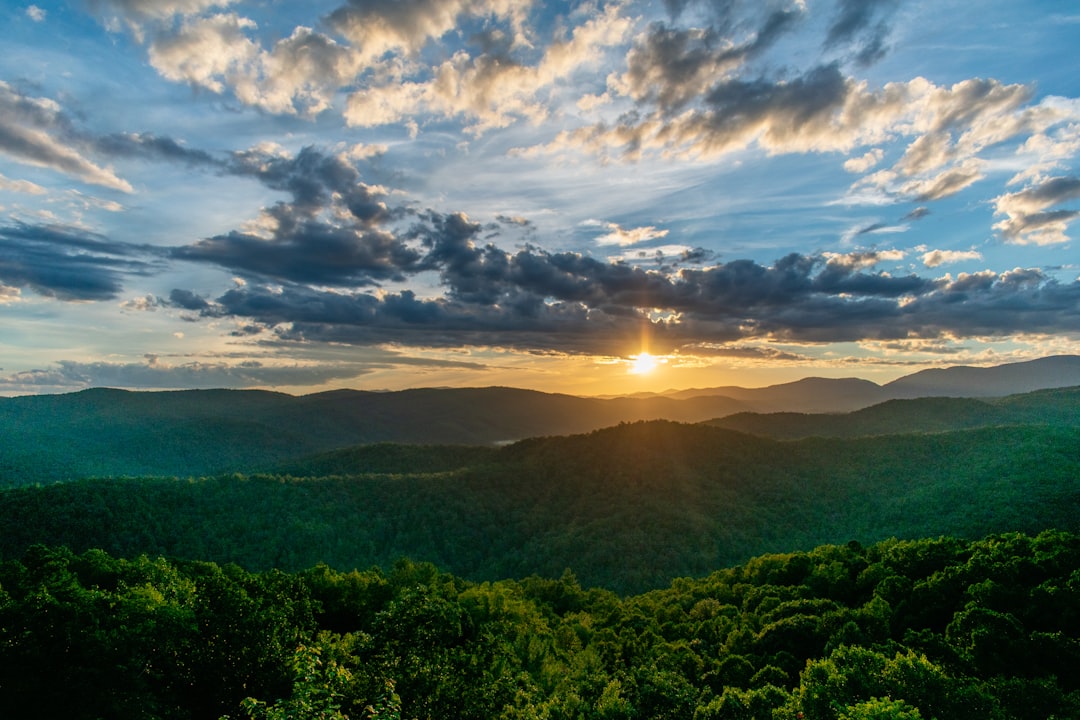
The connection drives (Foothills Parkway, Blue Ridge Parkway) pull you back to the ridgelines. The Smokies become a panorama. You see the shape of the range, the way valleys fold between peaks, the distance between where you are and where the park begins. These drives teach you the geography that the park-focused drives let you forget.
A non-hiker with one full day and a base in Gatlinburg or Pigeon Forge will get the most from Newfound Gap Road combined with either Cades Cove or Roaring Fork — an inside-the-park day that hits the Smokies' three main road characters.
A non-hiker with a base in Townsend might start with the Foothills Parkway at sunrise (when the light rakes across the Smokies from the east) and then enter the park at Cades Cove for the afternoon.
A non-hiker staying on the North Carolina side — Cherokee, Bryson City, Maggie Valley — has the unique option of combining Newfound Gap Road with the Blue Ridge Parkway in a single loop: drive Newfound Gap from Cherokee to Gatlinburg, return on US-441, and pick up the Parkway heading north for a second act.
A valid parking tag is required for any vehicle stopping for more than 15 minutes inside Great Smoky Mountains National Park. Vehicles simply driving through do not need a tag. Tags are available at automated kiosks throughout the park, at visitor centers, or online in advance at recreation.gov. Current pricing and tag options: nps.gov/grsm/planyourvisit/fees.htm
Newfound Gap Road stays open year-round but closes temporarily during and after winter storms. Kuwohi Road (formerly Clingmans Dome Road) is open to vehicles April through November. Roaring Fork Motor Nature Trail is typically open early to mid-April through November. The Blue Ridge Parkway's higher sections close in winter; check current status at nps.gov/blri. Foothills Parkway may close during high winds, ice, or snow events. Cades Cove Loop Road is closed to vehicles on select days during summer for cyclists and pedestrians; check nps.gov/grsm for the current schedule.
All scenic drives within the park are paved two-lane roads. Newfound Gap Road is the widest and most traveled. Roaring Fork and parts of Cades Cove are narrow, one-way, and do not accommodate large RVs well. The Foothills Parkway includes curves and bridges that are manageable for most vehicles, but oversized motorhomes should confirm overlook parking sizes before committing to stops.
Available at Sugarlands Visitor Center (Gatlinburg entrance), Oconaluftee Visitor Center (Cherokee entrance), Cades Cove Visitor Center, and the Kuwohi Visitor Center (seasonal). On the Foothills Parkway, the only restrooms are at Look Rock Picnic Area. The Blue Ridge Parkway has limited facilities; Waterrock Knob has a comfort station.
No gas stations inside the park or on the Blue Ridge Parkway. Fill up in Gatlinburg, Townsend, Cherokee, or Pigeon Forge before entering.
Most overlooks on Newfound Gap Road and the Foothills Parkway include accessible parking spaces. The Oconaluftee Visitor Center and Sugarlands Visitor Center are wheelchair accessible. The walk to the Kuwohi observation tower, while paved, is steep and not considered wheelchair accessible. Cades Cove's historic structures involve short walks on uneven ground.
April brings early wildflowers and waterfall volume from snowmelt. May puts rhododendron blooms on the higher elevations of Newfound Gap Road. June typically opens the full Blue Ridge Parkway after winter closures. For all routes, weekday mornings see lighter traffic than weekends.
The Smokies don't require boots to reveal themselves. They require a windshield, a willingness to stop when the view earns it, and — for the passengers who came along without trail plans — the right road chosen before the day starts. Whether that road stays inside the park or traces its outline from the ridgeline next door, the mountains hold up their end of the bargain.
Visitors planning a scenic driving trip to the Great Smoky Mountains can browse cabin and vacation rental options near Gatlinburg, Townsend, and Cherokee through DirectStay — where the booking connects directly with the property owner, no middleman fees attached.
Want to feature your business on the DirectStay Blog?
Want to feature your business on the DirectStay Blog?

Connect with travelers, share your space, and join a community of hosts earning together.
Become a host