Accessible scenic stops near Asheville surface a question worth asking before you leave the house: do you want the view that's already waiting when you open the car door, or do you want the one that asks you to walk a little—on ground you can trust? The Blue Ridge Parkway answers the first kind. Pull into an overlook, step to the railing, and the mountains are right there—no trail, no surface to read, no distance to negotiate. The view starts the moment the engine stops.
But some of the area's finest scenery sits just past the parking lot, along paths that were built to stay level and stay wide. The NC Arboretum runs paved routes through its gardens where the ground never surprises you. Lake Louise in Weaverville lays a flat loop around water so still you stop planning and start breathing. Bent Creek follows old forest roads wide enough that nobody has to move aside. None of this is wilderness. All of it is worth the question.
The Blue Ridge Parkway is built for this. Dozens of paved pull-offs line the Asheville corridor, each one engineered so the entire experience happens between the car and the guardrail. The French Broad Overlook near Milepost 393.8 puts the river below you, threading through hills without asking you to take a single step downhill. Tanbark Ridge Overlook opens a wide parking area to a 180-degree east-facing view—mountain ridges stacked to the horizon, and enough room to take it in from beside the car if that's where you're most comfortable. Farther south near Milepost 404, the Mills River Valley Overlook does the same thing facing a different direction.
What makes these stops work for access isn't just the view—it's that no transition is required. The surface is asphalt. The grade is flat. The distance from the car is measured in steps, not minutes. On a clear morning, you're standing inside the same panorama people hike hours to reach.
The catch is knowing which sections are open. The Parkway closes for ice, construction, and storm damage, sometimes with little notice. That's the planning part "easy" doesn't warn you about.
The step-out overlooks give you the mountains. The short-walk stops give you something else: the feeling of being inside the landscape instead of looking at it from the edge.
It sits at Parkway Milepost 393 on a 434-acre campus tucked into Pisgah National Forest. The main garden paths are paved and wheelchair accessible, and the Arboretum lends wheelchairs at no charge from the Education Center and Baker Exhibit Center on a first-come basis. The ground through the gardens is mapped, graded, and predictable. Walk through the Bonsai Exhibition Garden or along the cultivated beds and the scenery isn't a panorama—it's close, deliberate, and at eye level.
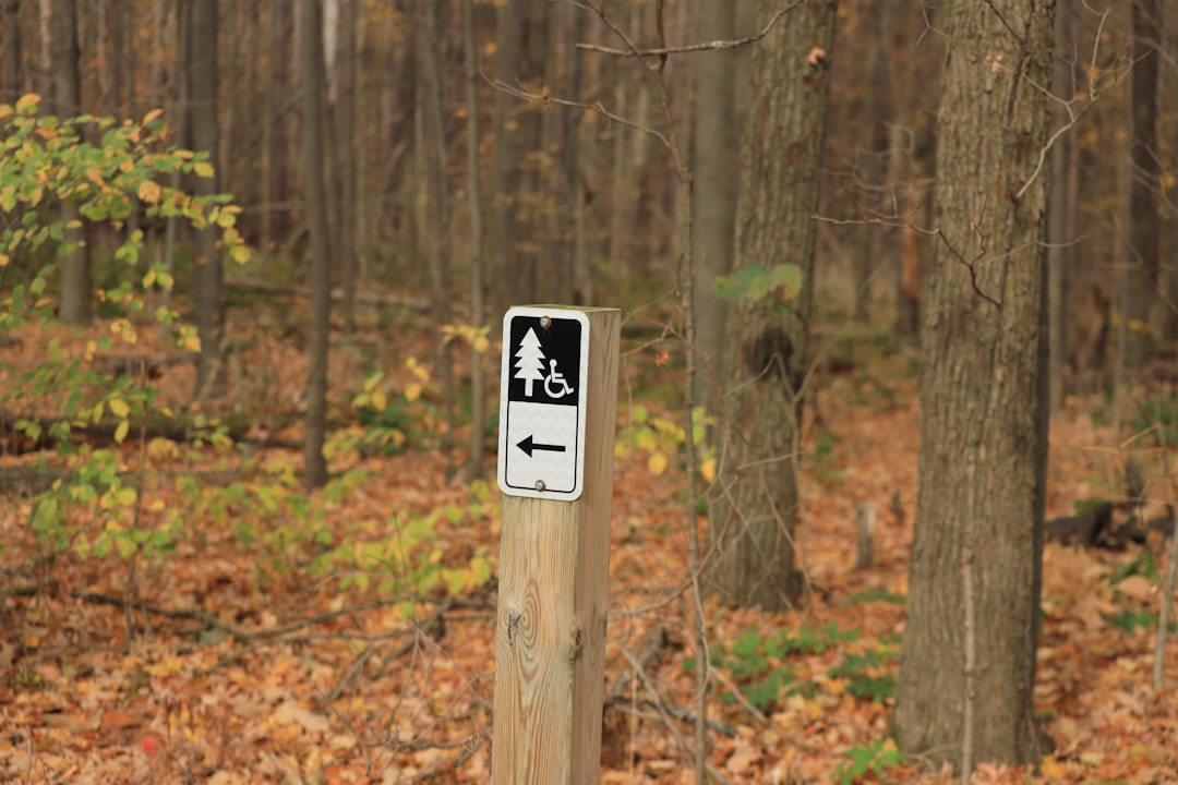
This one wraps a 0.6-mile loop around a man-made lake on mostly flat ground. The surface mixes paved concrete and packed gravel, and the elevation gain across the full loop is negligible. Benches line the path. The water holds still enough to reflect the trees back at you, and ducks drift close enough that kids stop walking to watch. It's the kind of place where the quiet does the work. Accessibility for wheelchair users—AllTrails notes "may need all-terrain tires or adaptive equipment."
It runs through forest service roads adjacent to the Arboretum—wide, graded corridors originally built for trucks, not hikers. The Bent Creek Road trail is twelve feet wide, gravel-surfaced, and follows the creek through the valley floor. This is the spot in the cluster that asks the most: the surface is natural, not paved, and rain turns gravel soft. But on a dry day, the width and the grade make it walkable for people who need room and predictability underfoot without needing pavement.
Most visitors assume accessible means uncomplicated. But every stop on this list carries a planning layer that the word "easy" doesn't advertise.
But the pattern locals learn through repetition is that accessible doesn't mean unplanned. The Parkway overlook that's perfect on Tuesday might be gated on Wednesday. The Arboretum's paved paths still sit at elevation, and a November drizzle coats them in leaf litter that hides the surface. Lake Louise's flat loop gets crowded on weekend afternoons. Even the wide Bent Creek roads turn to mud after heavy rain. The access is real—but it rewards people who check conditions before they leave the house, not just people who show up.
Two versions of the same thing: standing inside a view you didn't have to earn with your legs. One happens at the railing, engine still cooling. The other happens along a path that was built to hold steady beneath you. The mountains don't keep score—they just ask whether you showed up. The only question is how much ground you want between you and the car, and what kind of ground you trust to hold.
Do to the areas Inclement Weather and Hurricane Disaster Situations its best to call and Verify conditions ahead of time for Wheelchair and other accessible needs.
Blue Ridge Parkway Overlooks Check road status before every visit at DriveNC.gov or the NPS interactive map. The Parkway is free and open 24/7 when conditions allow, but ice, construction, and storm recovery close sections without advance notice. The Asheville corridor (MP 355–420) is currently the most reliably open stretch. No facilities at most overlooks—plan accordingly.
The North Carolina Arboretum Parkway Milepost 393. Admission is free;
parking is $20 per vehicle. (verify before planning)
Main garden areas and the Baker Exhibit Center are wheelchair accessible. Wheelchairs available free of charge, first-come basis. Hours shift seasonally—generally 8 AM to 7 PM in cooler months, 8 AM to 9 PM April through October. Cell service is limited inside the property.
Call directly: 828-665-2492 (their main line)
Their website has a visitor info section: ncarboretum.org/plan-a-visit
They also post closures/updates on their Facebook page
Ask specifically: "Which garden paths and trails are currently open, and are the paved garden routes fully wheelchair accessible right now?"
Lake Louise Park, Weaverville Open sunrise to sunset. Free to visit. The 0.6-mile perimeter loop mixes paved and packed gravel surface. Flat grade with benches throughout. Playground, picnic shelters, and restrooms on site. Note: Dogs are permitted on leash but not on the walking path itself—walkers with dogs use the adjacent roadway.
Town of Weaverville: 828-645-7116
Ask three things in one call:
Is there designated ADA parking at Lake Louise Park?
What is the current surface of the walking path — paved, gravel, or mixed?
Is the full loop wheelchair passable, or do sections require all-terrain equipment?
Bent Creek Adjacent to the NC Arboretum in Pisgah National Forest. No entrance fee for the trails (Arboretum parking covers access). The main corridor—Bent Creek Road—is a 12-foot-wide gravel surface. Natural surface trails are not paved and should be avoided after rain. Mountain bikers share the roads, especially on weekends. Some areas are subject to seasonal research closures—check USFS signage at trailheads.
Seasonal Notes Winter and early spring bring ice to overlook railings, Parkway pavement, and the Arboretum's garden paths. Leaf litter in fall can obscure surface conditions on all paved paths. Gravel surfaces at Bent Creek and Lake Louise soften after rain. Early morning visits in any season tend to mean fewer people and better parking access at popular stops.
Want to feature your business on the DirectStay Blog?
Want to feature your business on the DirectStay Blog?

Connect with travelers, share your space, and join a community of hosts earning together.